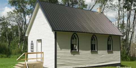
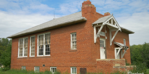
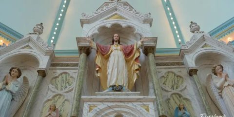
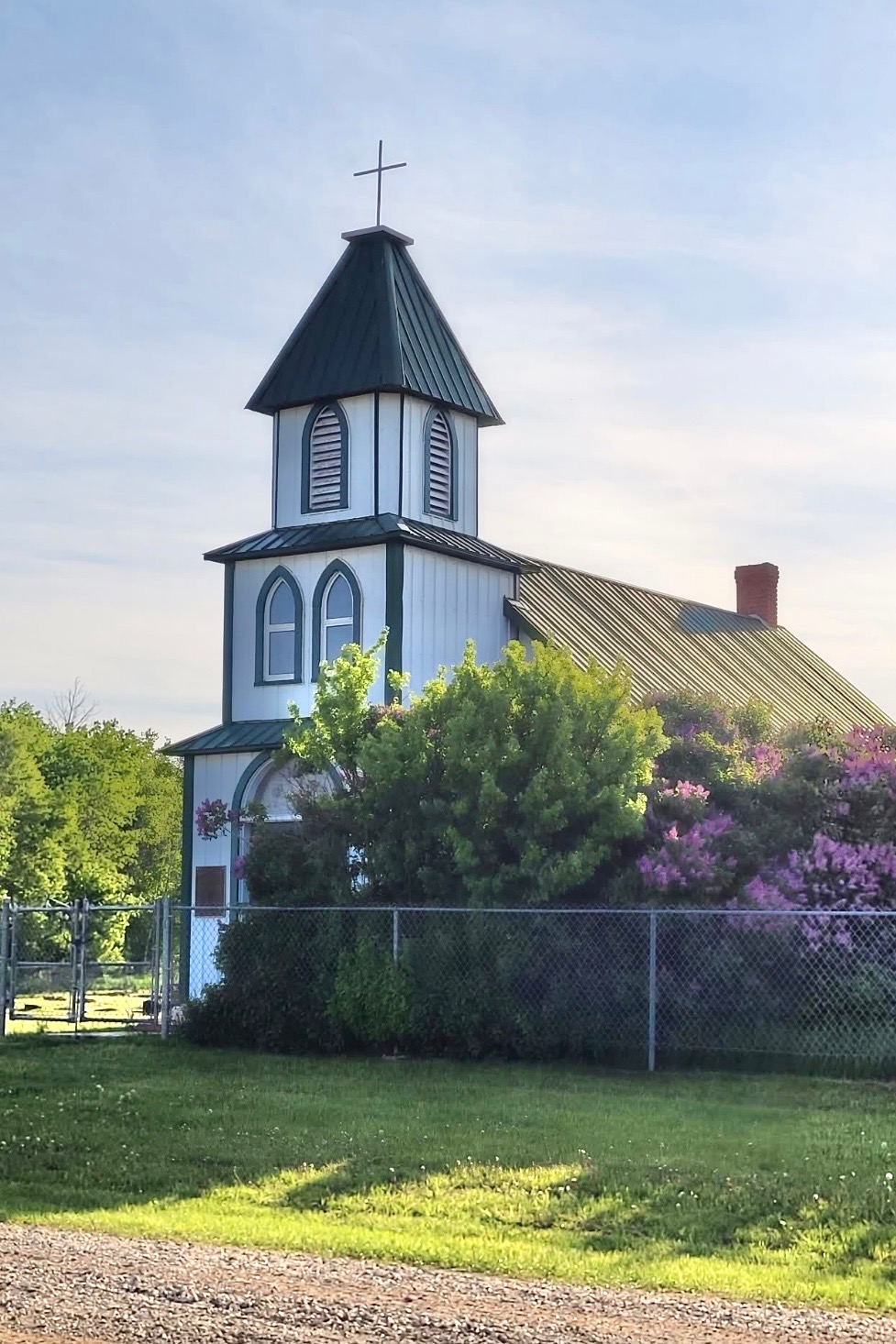
The history of St. Paul’s Lutheran Church begins long before the building itself. In the late 1890s and early 1900s, Lutheran settlers—many of Russian and German origin—began to establish homesteads throughout the Silver Grove district. In those early years, before a formal place of worship existed, services were held in private homes. As more families arrived and the community grew, worship moved to the Silver Grove School, providing a more centralized location for gathering.
Recognizing the need for a dedicated place of worship, the congregation came together in 1917 to build St. Paul’s Lutheran Church. The land was generously donated by Adam Reidt, and both materials and labour were provided by the church’s own members—a testament to the strength and commitment of the community. Services were conducted in German, the language of many of the settlers, and the church quickly became a focal point for spiritual life across a large rural area where, at the time, families lived on nearly every quarter section.
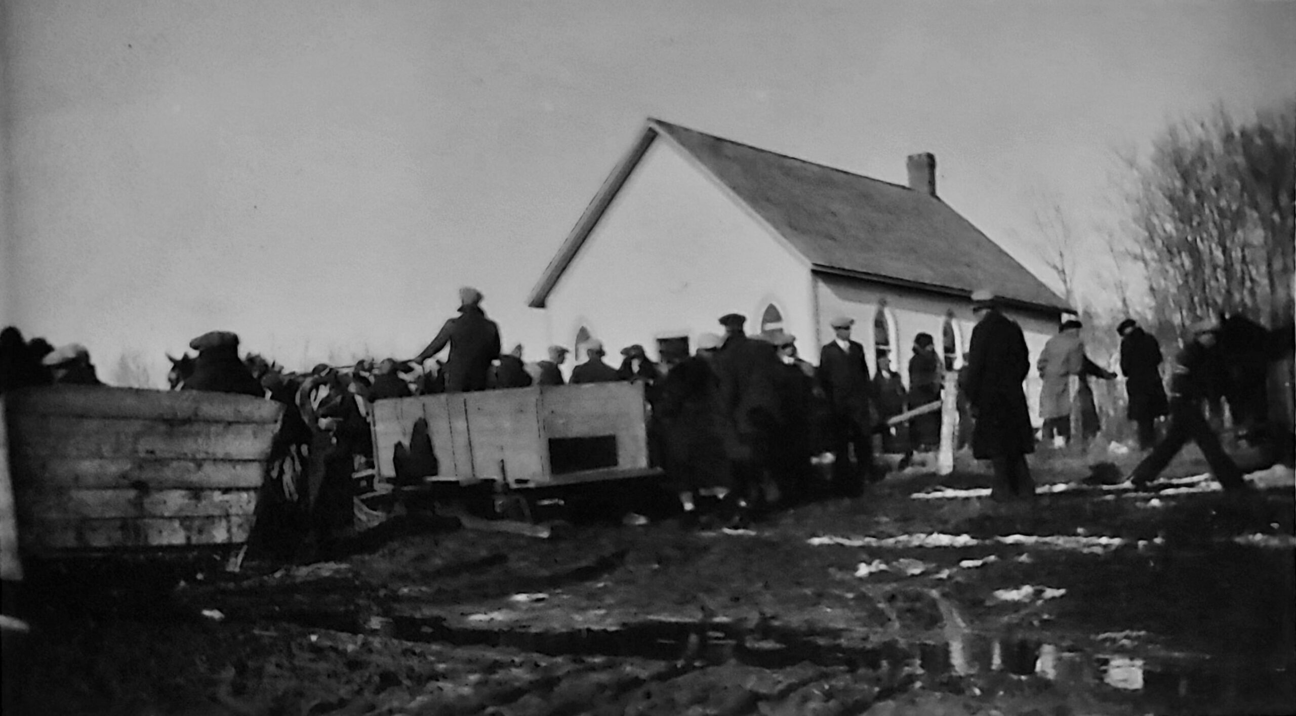
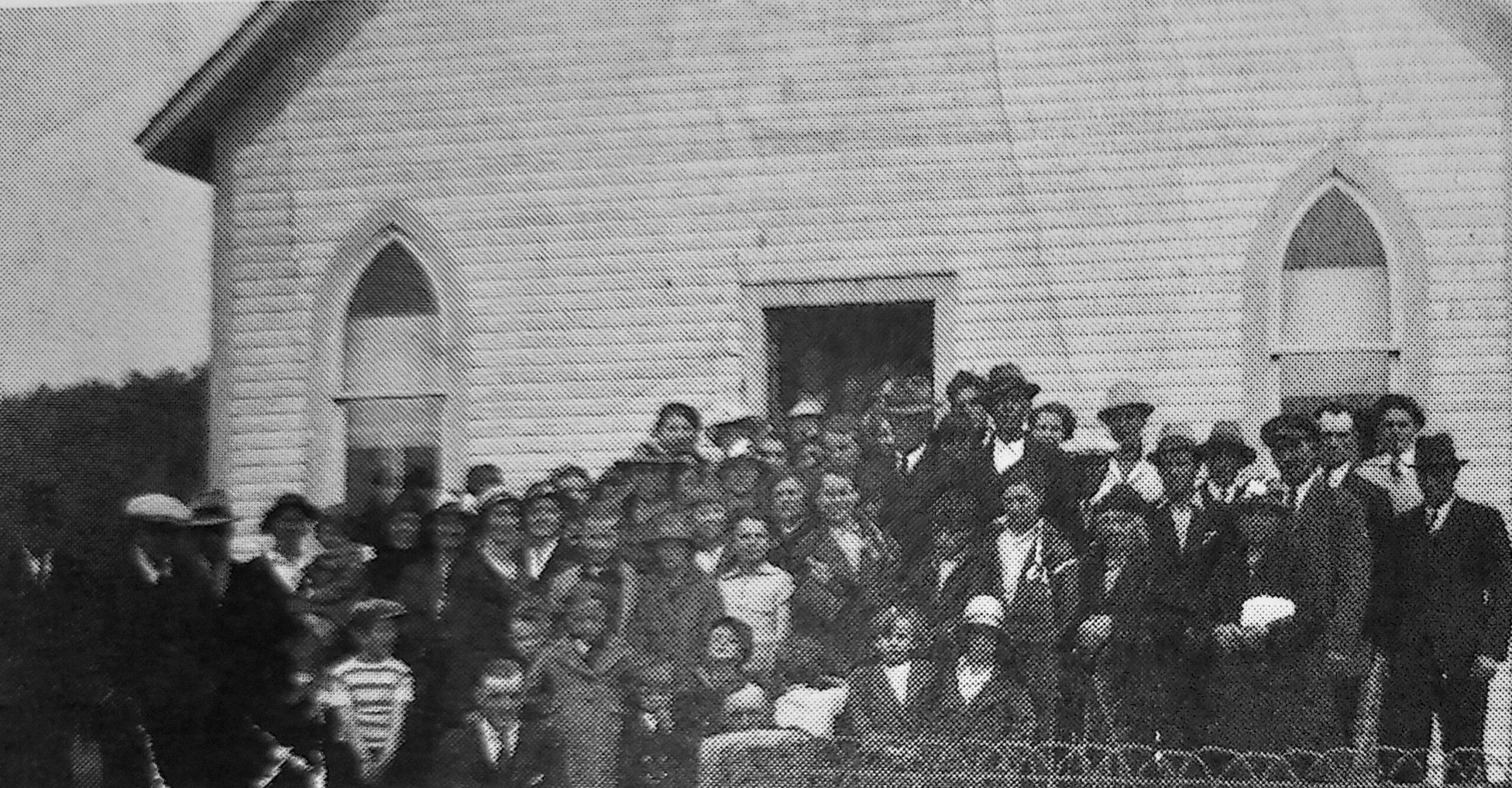
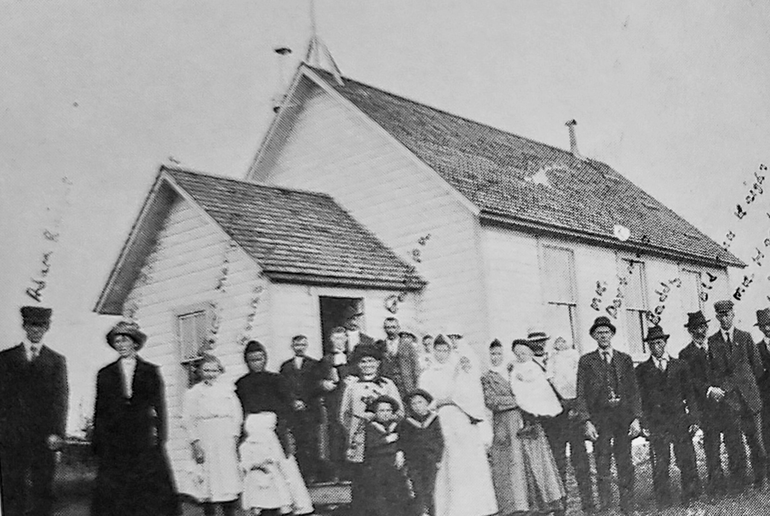
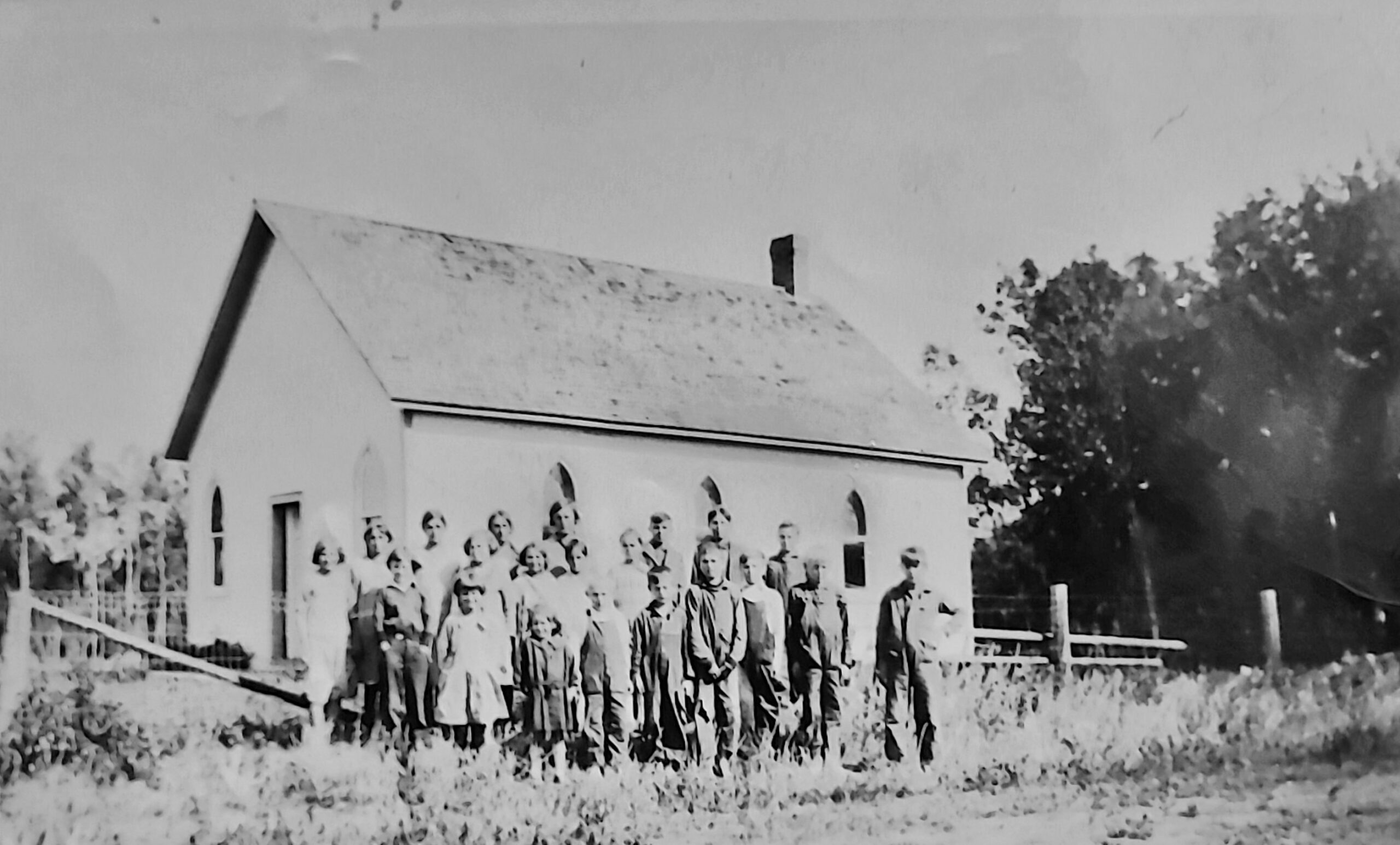
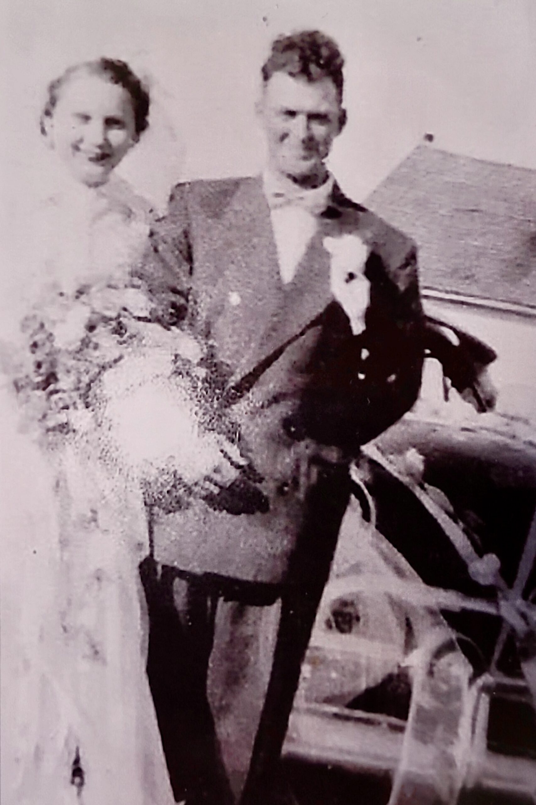
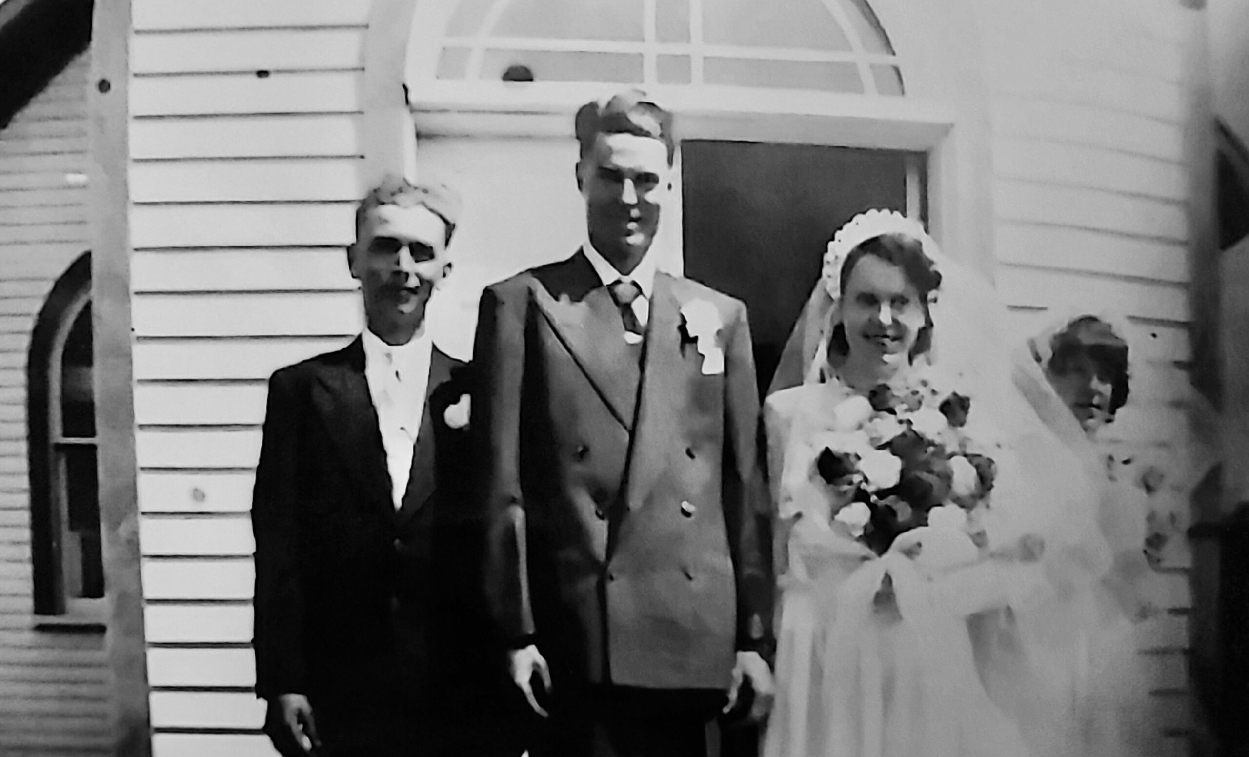
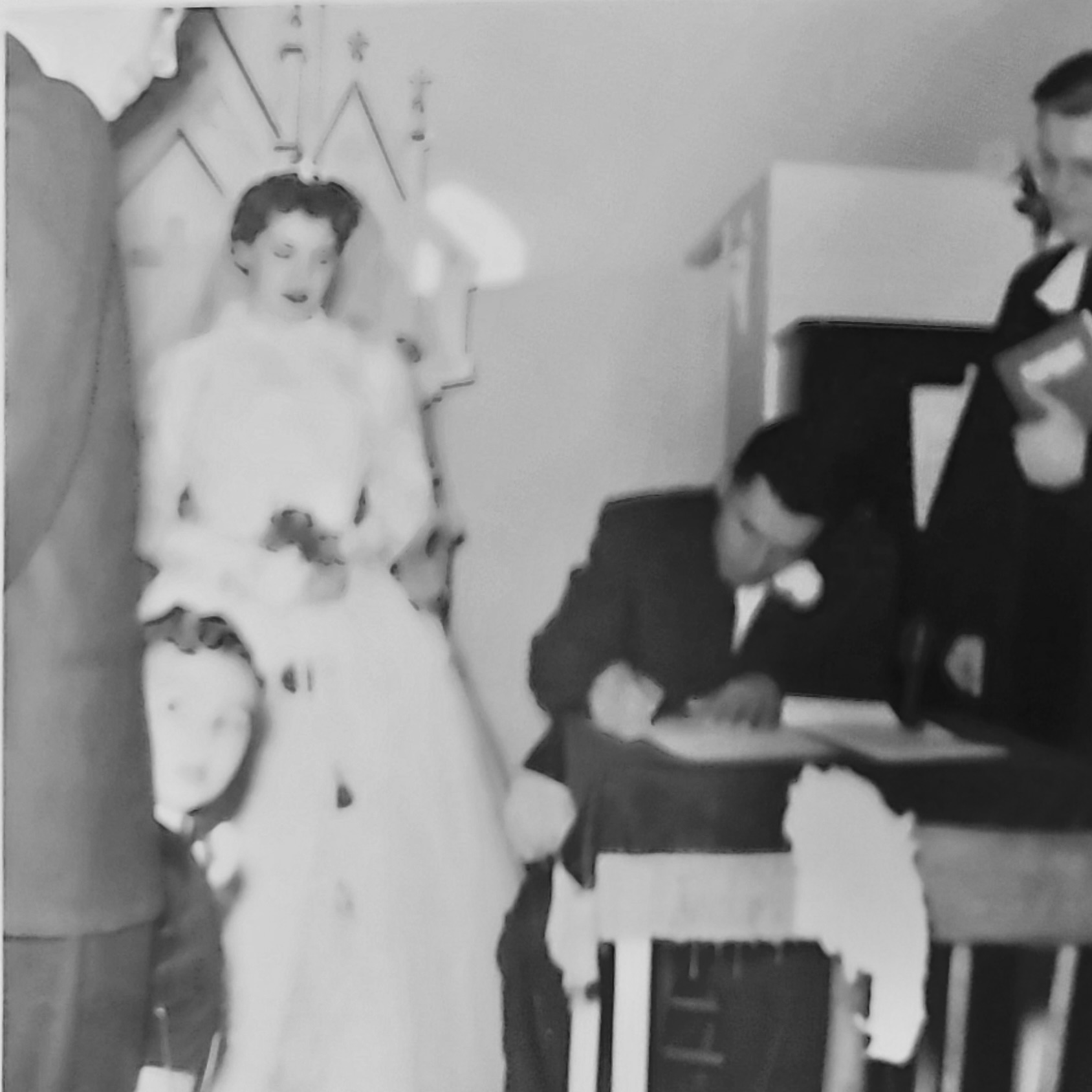
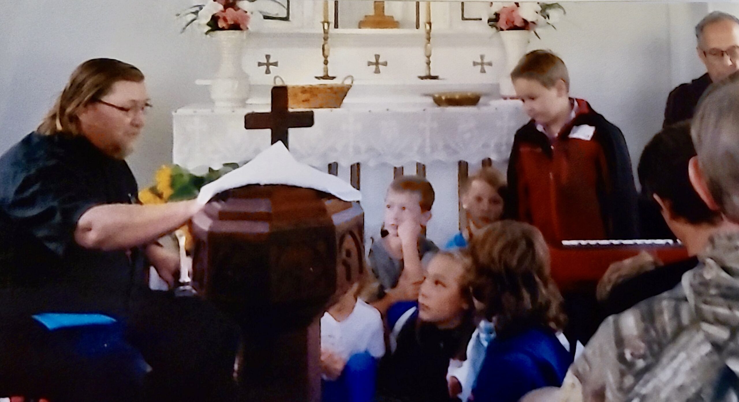
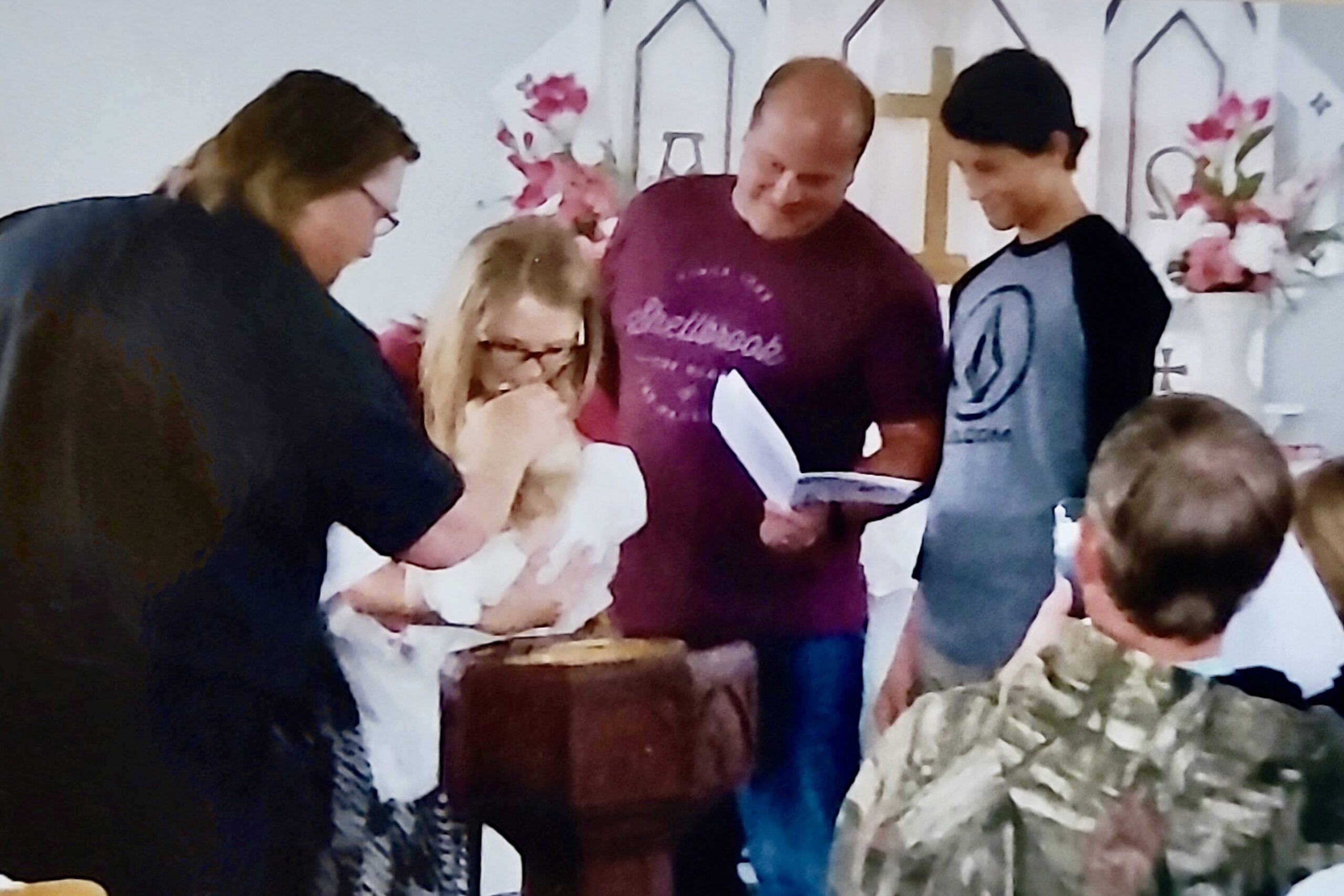
St. Paul’s became much more than a place of worship. It was a centre for learning, celebration, and community life. The church hosted Saturday School and Christmas programs—complete with towering Christmas trees—as well as baptisms, confirmations, weddings, funerals, and committals. Some of the earliest recorded milestones include the baptism of John Hugo Reidt in 1900 and confirmations dating as far back as 1902.
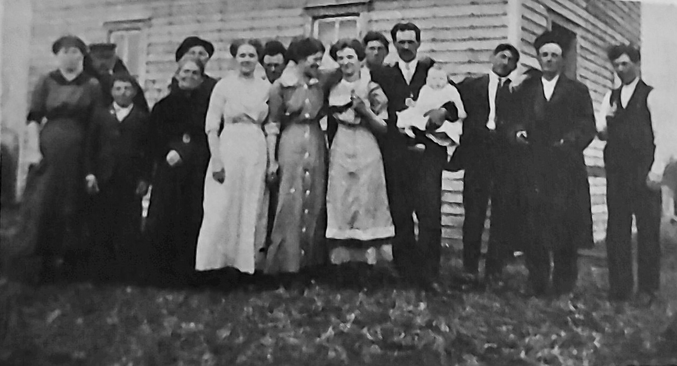
Family names found in the church’s early registers reflect the cultural fabric of the district: Reidt, Riffer, Thiel, Bischler, Urbinsky, Ehrstein, Dehring, Schultz, Seiter, Dortman, Schlichemeyer, Saam, Hoffman, Edel, Bittner, Stieb, Hohn, Kron, Krause, Beck, Mueller, Sommerfeldt, Lenz, Rabel, Ruchotzke, Steinbart, Gutsch, Hek, Bergen, and Gampe.
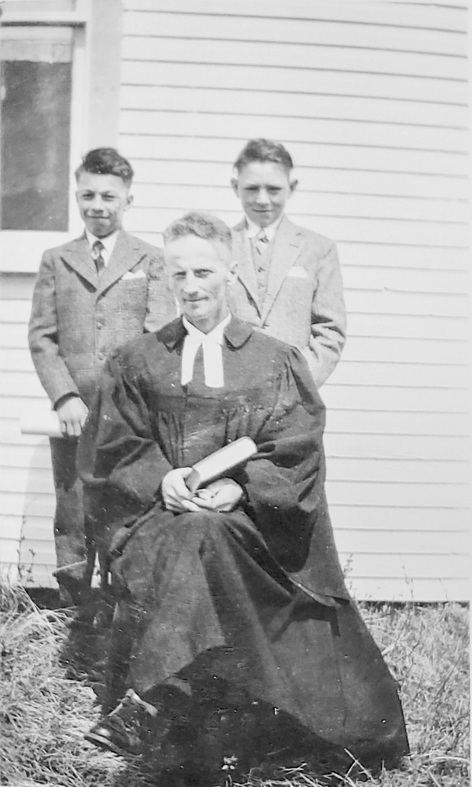
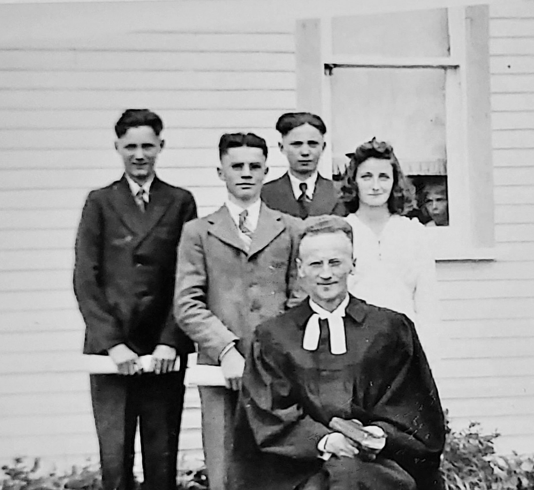
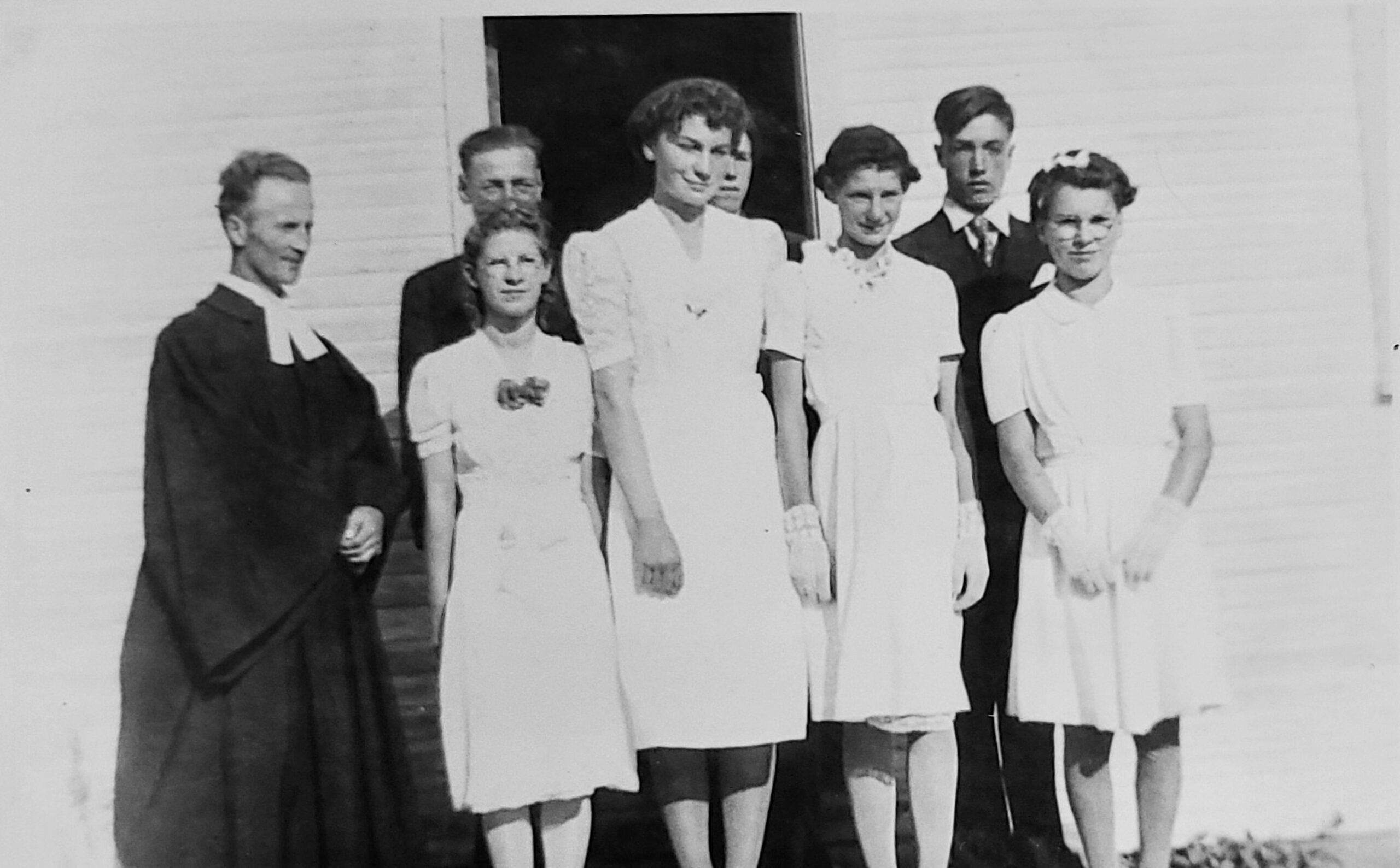
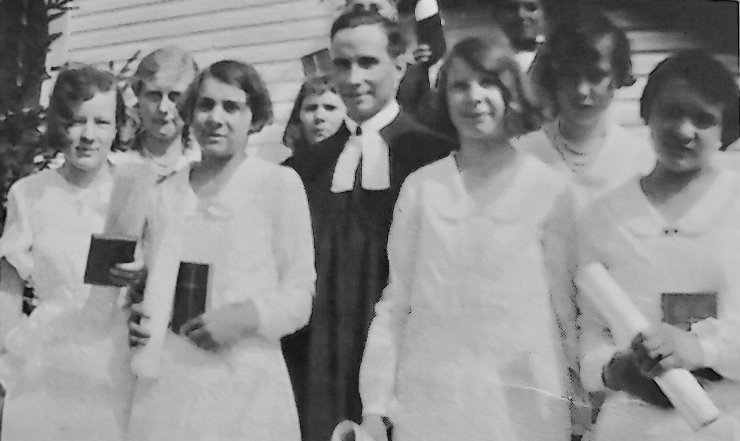
Pastors who served St. Paul’s over the decades included Rev. Hugo Lanz, Magnus, Weidenhammer, Freitag, Risch, Klingbeil, Schwabe, Penner, Adelsberger, Intscher, Sterzer, and Erickson—each leaving a mark on the spiritual life of the community.
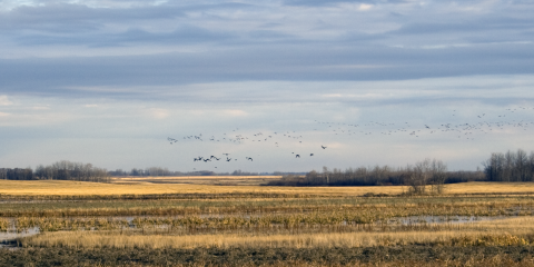
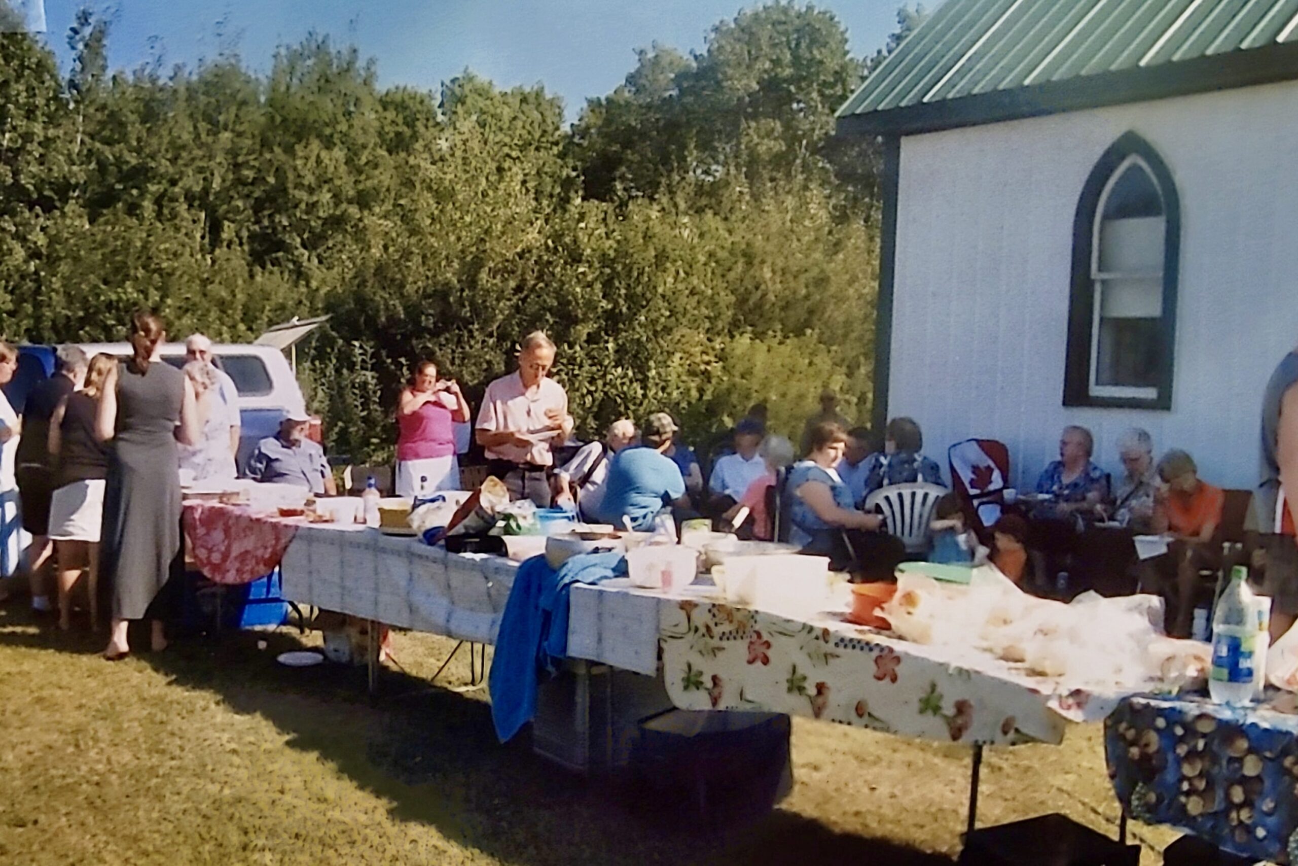
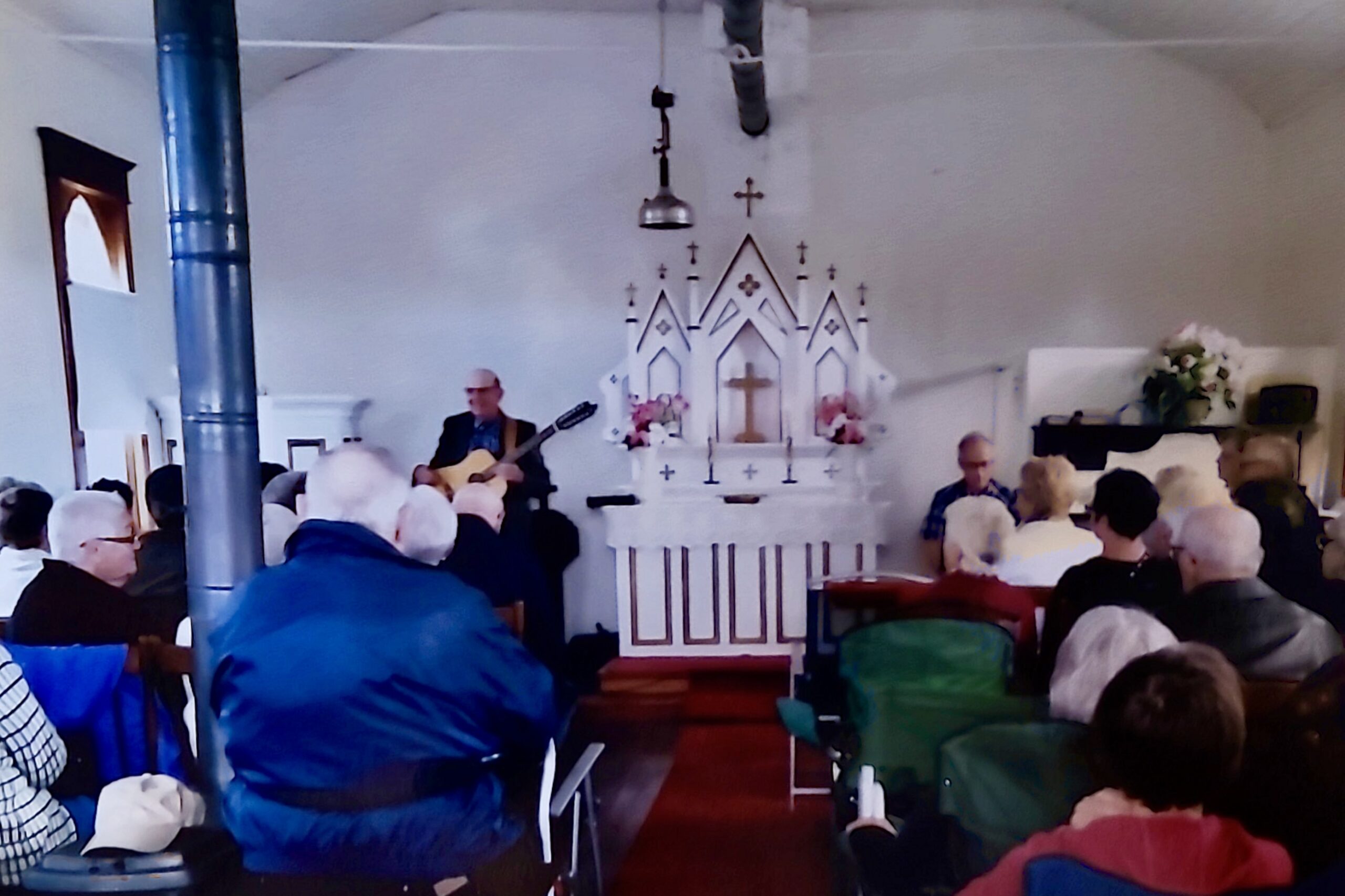
As the decades passed, life in the countryside began to change. Families grew and moved away, farms became larger and fewer, and rural populations began shifting toward towns and cities. By the late 1950s, regular weekly services at St. Paul’s began to decline, particularly in the winter months. By the mid-1960s, worship at St. Paul’s had been reduced to an annual summer service and picnic—an occasion that continues to bring together descendants, neighbours, and friends.
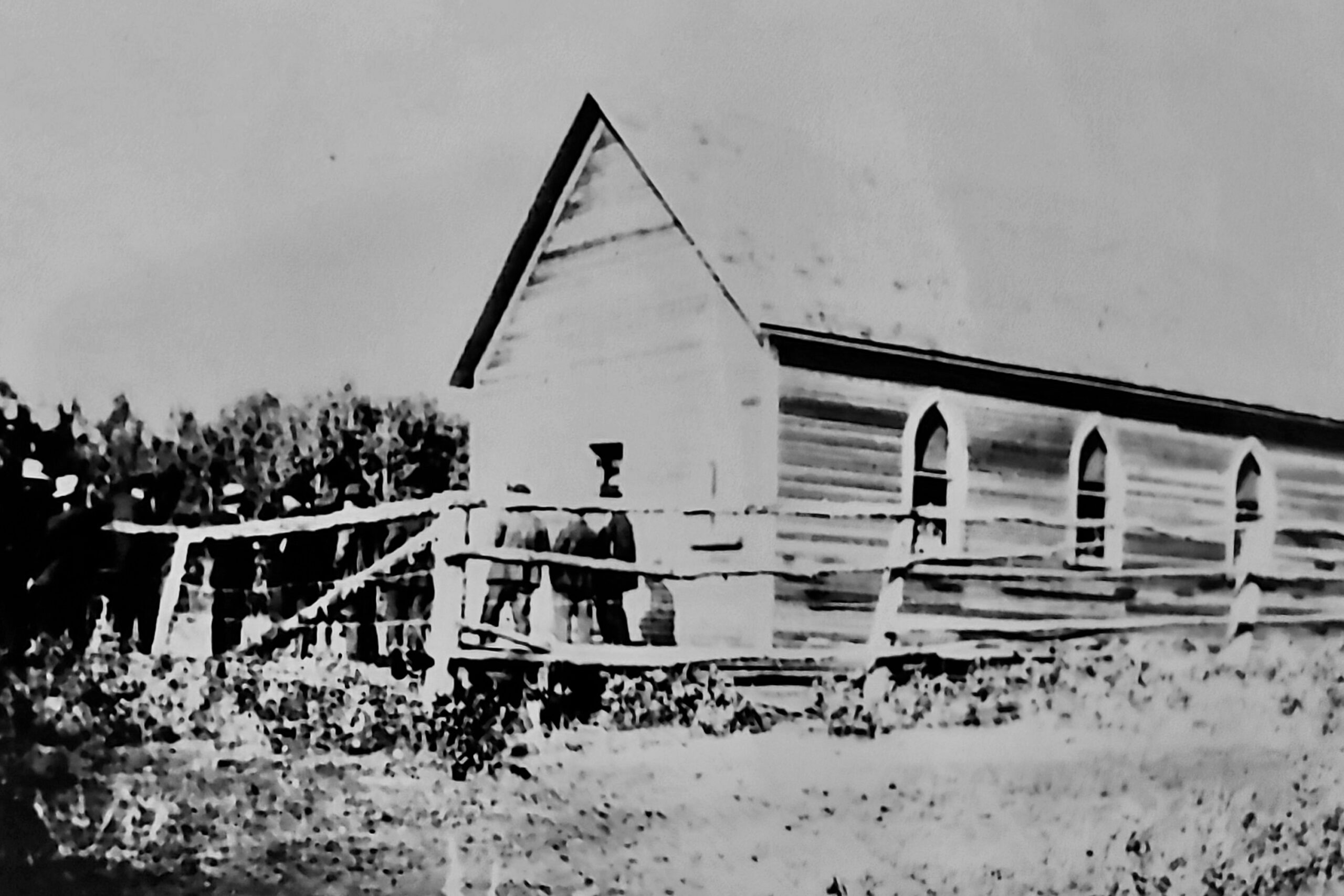
In recognition of its historical and cultural significance, the Province of Saskatchewan officially designated St. Paul’s Lutheran Church a Municipal Heritage Site in 1984. This designation, along with ongoing support from former congregants, their families, and heritage grants, has helped ensure the preservation of the church building and grounds.
Today, more than a century since it was built, St. Paul’s Lutheran Church remains a beloved symbol of faith, community, and resilience. It stands as a quiet witness to the lives and stories of those who made the Silver Grove district their home—and a place where new generations can connect with that enduring heritage.
The town was settled in the late 1800s and grew rapidly with the Doukhobors’ arrival in 1899. It was, and is, a farming and business hub with many amenities and services.
Here, near the site of Pazeraevka village, Doukhobors who had come from Russia, and their descendants, gathered over the decades to celebrate ‘Petrov Dien’ or Peter’s Day on June 29th each year.
This cemetery, established at the turn of the last century by the Congregational Church of Canada, is the resting place of William Diehl (1850 – 1936). Diehl was one of three scouts during the Northwest Resistance of 1884-85 to whom Louis Riel surrendered.
As you travel east of Blaine Lake toward Marcelin and Leask, the landscape reveals the primary engine of the Riverlands’ economy: its soil. This region is a transition zone where the open prairie meets the aspen parkland, creating a unique agricultural environment that has supported generations of diverse farming practices.
The productivity of this area is due to its Chernozemic soil—a term derived from the Russian words for “black earth.” As described in the University of Saskatchewan’s Saskatchewan Soil Survey (Report No. 12), these deep, organic-rich soils were formed over thousands of years by the decomposition of tallgrass prairie and aspen parkland vegetation. The presence of this “black gold” was the primary draw for the Doukhobor and European settlers at the turn of the century, as it offered some of the highest fertility rates in Western Canada, particularly for cereal crops.
In the early 1900s, this area was the heart of “mixed farming.” According to the history book Bridging the Years: Era of Blaine Lake and District 1790-1980, pioneers did not rely on a single crop; they balanced wheat and oats with livestock, legumes, and oilseeds to ensure survival against the unpredictable prairie climate. This diversity acted as a natural insurance policy. Over the decades, as machinery replaced horsepower, the region transitioned toward the vast fields of canola and durum wheat seen today, though the varied “sandy loam” patches still allow for a wide range of specialty crops that are less common in the flatter, heavier clay regions to the south.
The rolling topography and varied soil types—ranging from heavy black soil to lighter sandy loams—are the result of the last glacial retreat. The Saskatchewan Geological Society records indicate that as the glaciers melted roughly 10,000 years ago, they left behind “glacial till” and outwash deposits that formed the undulating hills and sloughs of the Blaine Lake area. This geography forced settlers to adapt their field patterns to the land’s natural contours, leading to the picturesque, non-linear farmscapes that define the Riverlands today.
The Ospennia School district represents a significant milestone in the history of the Riverlands, marking the transition of the local Doukhobor community into the broader Canadian social fabric. Founded in 1909, the school served the families of the nearby Ospennia village, becoming a hub of literacy and cultural exchange for nearly half a century.
Like many surrounding settlements, the village of Ospennia was named by Doukhobor pioneers to honor their roots. According to the Doukhobor Genealogy Website, “Ospennia” (also spelled Uspenie) refers to the “Dormition” or “Assumption,” a term rooted in the Russian Orthodox calendar that the Doukhobors carried with them as a geographic namesake, despite their break from the formal Church. The establishment of a school here was a major step; as noted in the Saskatchewan Department of Education records, the district was only formed after intensive petitioning to the government by local families who sought to ensure their children were prepared for life in a rapidly changing Saskatchewan.
The history of the school building itself is one of resilience. The original structure opened its doors in 1911, but its service was cut short by the unpredictable prairie elements. As documented in the community history Bridging the Years: Era of Blaine Lake and District 1790-1980, the first schoolhouse was struck by lightning and suffered severe damage. Rather than abandon the district, the community rallied to rebuild at a new location (SE–2–44–6 W3). This second schoolhouse became the heart of the district until 1957, hosting not only classes but also community dances, debates, and local meetings.
For many students at Ospennia, the school was their first sustained contact with the English language and non-Doukhobor traditions. Memoirs cited in the Blaine Lake Museum archives describe the early years where teachers—often young women from Ontario or the Maritimes—lived in small “teacherages” on the school grounds. These educators played a vital role in the “Canadianization” of the district, though they often learned as much from their students about Russian choral singing and communal values as the students learned about British history and mathematics.
By the late 1950s, the era of the one-room schoolhouse was ending as Saskatchewan moved toward school consolidation. When Ospennia School officially closed in 1957, students were bussed into Blaine Lake. Today, the site stands as a quiet tribute to the “University of the Prairies”—the small, isolated buildings that provided the foundation for the region’s professional and agricultural success.
Standing as one of the most recognizable natural landmarks in the Riverlands, the “Big Tree” is more than just a biological marvel; it is a living link to the pre-settlement era. Estimated to be over 160 years old, this massive tree was already a mature landmark when the first pioneers arrived in the district at the end of the 19th century.
While it is often referred to simply as a cottonwood, the Big Tree is actually a natural hybrid of the Plains Cottonwood (Populus deltoides) and the Balsam Poplar (Populus balsamifera). According to biological surveys cited in Saskatchewan’s Nature Conservancy records, such hybrids are rare in their ability to reach these dimensions. Currently, the tree stands at 21 meters tall, though it was once significantly higher before a lightning strike sheared off its crown. With a girth of 5 meters and a canopy span reaching 32 meters, it remains one of the largest trees of its kind in the province.
The survival of the Big Tree is largely credited to the personal stewardship of the Popoff family, particularly Sam Popoff, who owned the land for many years. As noted in the local history book Bridging the Years: Era of Blaine Lake and District 1790-1980, while many giant trees in the region were harvested for homestead lumber or fuel, the Popoffs recognized the tree’s unique character and chose to protect it. Sam Popoff often welcomed visitors and shared stories of the tree’s history, effectively acting as its unofficial curator. This family legacy ensures that the tree remains a point of pride for the local community and a permanent fixture of the Riverlands landscape.
The tree’s location near the historical site of the Laird Ferry made it a vital landmark for travelers. As documented in Saskatchewan Department of Highways ferry records, the Laird crossing was a central lifeline for moving grain and mail across the North Saskatchewan River. The Big Tree served as a natural beacon for those approaching the riverbanks, visible for miles across the relatively low-lying scrub and brush. Its massive canopy provided a recognizable point of reference for decades of ferry operators and homesteaders navigating the river valley.
Because of its extreme age, the tree has witnessed the complete transformation of the Riverlands. It stood during the peak of the fur trade traffic on the river, through the 1885 Resistance, and watched as the communal Doukhobor villages transitioned into modern family farms. As noted in the Saskatchewan Register of Heritage Assets, the preservation of such “Ancient Trees” is critical not just for biodiversity, but as a form of natural heritage that provides a tangible sense of time and scale to the human history of the district.
As the tour continues, one passes the location of cemeteries, old village sites, and other historical entities. This cemetery served the nearby village of Ospennia, one of 12 villages within the Prince Albert land reserve set aside for Doukhobor people.
Located on NE 17 – 44 – 5 W3, this cemetery serves the Slavanka district. The cemetery house has been decorated in a style that has been influenced by Doukhobor settlers who arrived from southern Russia. Visitors are encouraged to spend time contemplating the passing of history, pay respect to those buried at Slavanka cemetery, and sign the guest book.
Saskatchewan is surveyed on a grid system with individual quarter sections measuring ½ by ½ mile. The measurement of river lots at Riverhill is different, affording proximity to the river.
Established in 1910, the Riverhill School was the educational anchor for the families living along the river lots and the surrounding homesteads. It stood as a beacon of progress in a region that was still very much a frontier, serving as both a classroom for the young and a meeting hall for the community at large.
Classes officially began at Riverhill in February 1912 with an initial enrollment of 14 students. These children often walked several miles—or arrived by horse and buggy—to reach the schoolhouse. As documented in the community history Bridging the Years: Era of Blaine Lake and District 1790-1980, the original building served the district faithfully for nearly two decades until it was tragically destroyed by fire in 1931. The loss of a school was a major crisis for a rural community, but the families of Riverhill acted quickly. A new, more modern schoolhouse was soon constructed on Riverlot North 7–45–5 W3, ensuring that the education of the district’s youth was not long interrupted.
In the era before community centers and paved highways, the school was the only public building in the district. According to Saskatchewan Department of Education records, Riverhill hosted everything from local elections and municipal meetings to Saturday night dances and Christmas concerts. The teacher, who often lived in a small attached suite or a nearby teacherage, was a central figure in local life, frequently serving as an unofficial secretary or advisor to the community.
The geography of the school district was unique because of the river lot system. While children in square-grid districts lived in a relatively compact area, the Riverhill students were spread thin along the narrow, two-mile-long river lots. As noted in the Saskatchewan Archives Board memoirs, winter attendance was a constant battle against the river valley’s microclimate, where deep snow in the coulees could make the short distance to school feel like an expedition. Despite these challenges, the school remained open until the late 1950s, when the province-wide shift toward larger, centralized schools led to its eventual closure.
This memorial honors the people of the region who developed the land. Based on a sun dial design from the Renaissance Period, the armillary takes into account the latitude of the area, 53° N of the equator. A gnomon (arrow) points to Polaris (North Star) which remains nearly constant over the North Pole. The gnomon’s shadow is cast upon the numbers of the horizon ring, indicating real time. Riverhill Cemetery continues to function as a focal point of the district. Visitors are welcome to stop by and sign the guest book.
As you travel through the rolling hills of the Riverlands, you will notice frequent “potholes” or sloughs dotting the landscape. These are not just decorative features; they are the lifeblood of the prairie ecosystem. This site provides an ideal vantage point to observe the complex interaction between water, land, and the hundreds of species that depend on these wetlands for survival.
A typical Aspen Parkland slough is a sophisticated natural filtration system. According to the Ducks Unlimited Canada wetland classification guide, these basins are characterized by distinct concentric zones of vegetation. It begins with a “wet meadow” perimeter—often lush with sedges and grasses—that transitions into a “shallow marsh” zone of cattails and bulrushes, eventually leading to deep open water in the center. These zones act as a sponge, soaking up spring snowmelt and heavy rains, which recharges the local groundwater.
The Riverlands sits directly beneath the Central Flyway, one of the major migratory routes in North America. At this specific location, it is possible to sight more than 15 species of waterfowl throughout the year. As documented in Saskatchewan Environment’s biodiversity reports, these sloughs are critical nesting grounds for Mallards, Blue-winged Teal, and Canvasbacks. Beyond ducks, the marshes support a noisy chorus of Red-winged Blackbirds, American Bitterns, and various shorebirds.
Historically, these wetlands were often seen as obstacles by early homesteaders. As noted in Bridging the Years: Era of Blaine Lake and District 1790-1980, “pothole farming” required settlers to navigate their machinery around dozens of small sloughs per quarter-section. However, the Saskatchewan Soil Survey (Report No. 12) highlights that these wetlands help maintain local humidity and soil moisture levels, acting as a natural buffer against the droughts that periodically sweep across the plains.
Long before the highway system or the railway defined the Riverlands, the landscape was crisscrossed by ancient trails. The Fort Carlton – Green Lake Trail is the most storied of these, serving as a vital artery that connected the North Saskatchewan River to the fur-rich regions of the north and the trade hubs of the east and west.
The trail’s history stretches back into prehistory. According to archaeological surveys cited by the Royal Saskatchewan Museum, many sections of the trail began as Indigenous pathways following the seasonal migration of the great buffalo herds. These animals naturally sought out the easiest terrain through the rolling parkland, carving deep ruts into the prairie sod that would eventually be adopted by human travelers. In the late 1700s, explorers and fur traders recognized the strategic value of these paths, incorporating them into a massive overland network that linked Fort Garry (Winnipeg) to Fort Edmonton.
Known locally as the “Snake Plain Trail,” this specific stretch winds northwest through the heart of the historic parkland. As documented in the Hudson’s Bay Company Archives, this section was crucial for transporting supplies from Fort Carlton to the northern outposts at Green Lake and beyond. It was a rigorous route that required travelers to navigate around numerous sloughs and through thick stands of aspen. By the mid-1800s, the trail was alive with the sound of “prairie screech”—the high-pitched wail of ungreased wooden axles on Red River Carts—as massive brigades of Métis traders moved freight across the plains.
The trail’s importance declined with the arrival of steamboats and the completion of the Canadian Pacific Railway, which shifted the primary trade routes further south. However, the physical imprint of the trail remains. As noted in the local history book Bridging the Years: Era of Blaine Lake and District 1790-1980, the modern drive from Carlton Crossing to the Town of Leask follows much of this original path. Traveling this route today offers a glimpse of the countryside as it appeared to the fur traders and early settlers.
Founded by Dr. Benjamin Ralph in 1904, Craigmore was named after a college in Ireland. Dr. Ralph arrived in the district to homestead and to provide leadership, serving with distinction until his death in 1930. His grave is in the Craigmore Cemetery. Considered by many to be among the most peaceful and serene locations in Saskatchewan, this idyllic little country church is a favorite spot to visit.
This vantage point offers one of the most significant historical panoramas in Western Canada. Standing high on the west bank of the North Saskatchewan River, you are looking out over a natural funnel that has drawn travelers, hunters, and soldiers to this specific spot for thousands of years.
For millennia, this was a traditional crossing point for Indigenous hunters following the buffalo. When the fur trade expanded, the Hudson’s Bay Company (HBC) recognized the site’s importance, establishing Fort Carlton directly across the river. As documented in the Hudson’s Bay Company Archives, the Fort served as a “provisions post,” where bison meat was converted into pemmican to fuel the canoe brigades heading into the far north.
Carlton Crossing was a focal point during the 1885 Resistance. Because it was the main supply link for the North-West Mounted Police (NWMP), controlling this crossing was a high priority for the Métis forces led by Gabriel Dumont. According to accounts in Bridging the Years, the NWMP were forced to abandon and accidentally burn the Fort in March 1885, using this very crossing to retreat toward Prince Albert.
Perhaps the most lasting legacy of this site occurred in August 1876. On the flats across the river, representatives of the Crown and the Plains and Wood Cree met to negotiate Treaty Six. As noted by the Office of the Treaty Commissioner, this location was chosen because it was a neutral, well-known gathering place. The negotiations held here marked the fundamental transition from the era of the fur trade to the era of settlement.
Today, the river flows much as it did in the 1800s, though the bustling trade hub has been replaced by the quiet of Fort Carlton Provincial Park. Looking across, you can see the partially reconstructed palisades of the Fort, standing as a silent reminder of the days when this crossing was the busiest “highway intersection” in the West.
Located on NE 28-45-4-W3, Chellwood School served as the heart of a predominantly English-speaking pocket of the Riverlands. Its founding is a classic example of the grassroots democracy that defined early Saskatchewan, where a few neighbors could transform a section of wild prairie into a center of learning.
The school takes its name from the village of Chelwood in Somerset, England. This naming choice followed a common pattern among early settlers, who often named their new school districts after their places of origin. As noted in the Saskatchewan Archives Board memoirs, the district was officially established in 1909 following a decisive meeting of just four local homesteaders.
In 1910, the school opened its doors to 20 students. Unlike the modern educational system, the early days of Chellwood relied on the teacherage—a small house provided for the teacher. According to Bridging the Years: Era of Blaine Lake and District 1790-1980, attracting a qualified teacher was one of the biggest challenges for rural districts. Providing a house was a significant draw, ensuring that the teacher could become a permanent, respected member of the local social fabric. The school operated for over 50 years, finally closing its doors in 1961.
Because Chellwood was located in a diverse region, the school often served as a linguistic and social bridge. As documented in Saskatchewan Department of Education records, the school board members were responsible for everything from hauling wood for the winter stove to organizing the “School Fair.” Today, the site remains a marker of that early 20th-century ambition, where the dream of a Somerset village was reborn in the fertile soil of the North Saskatchewan valley.
The Riverlands is a biological “crossroads.” The transition from the North Saskatchewan River valley to the upland parkland creates a diverse range of micro-habitats, supporting a surprising variety of wildlife—from tiny shrews to elusive apex predators.
Within this region, over 50 species of mammals have been documented. The river valley acts as a natural highway for larger animals moving between the northern forests and the southern plains.
The Riverlands holds a special distinction as a critical “staging area” for the endangered Whooping Crane. According to naturalist Trevor Herriot, this region is part of the “ancient homeland” for these birds, which once nested throughout southern Saskatchewan. Today, they use the wetlands near Marcelin and Blaine Lake as their primary stopover during fall migration.
Standing nearly 1.5 meters tall, these majestic white birds are often seen in stubble fields alongside Sandhill Cranes. As documented by the Canadian Wildlife Service, it is not uncommon to see a significant percentage of the world’s wild population resting in the Riverlands during October, refueling for their long flight to the Gulf of Mexico.
The Riverlands is a premier destination for birdwatchers, with over 200 species sighted annually. As documented in the Saskatchewan Breeding Bird Atlas, the region serves as a critical stopover for migratory songbirds and nesting grounds for birds of prey like the Red-tailed Hawk and the Great Horned Owl.
Wildlife in the Riverlands has adapted to the agricultural landscape. As documented in Bridging the Years, early settlers had a complex relationship with local fauna. Today, many local producers help maintain biodiversity by preserving shelterbelts and natural bluffs, ensuring that the Riverlands remains a shared home.
The Riverlands is located in one of the most unique ecological zones in North America: the Aspen Parkland. From this vantage point, you can clearly see the “tension zone” between the dry, open grasslands to the south and the cool, damp boreal forest to the north.
What makes the Aspen Parkland distinct is its mosaic-like appearance. As noted in the Saskatchewan Ecoregion Classification Service, this landscape is a patchwork of “bluffs” (groves of Trembling Aspen and Balsam Poplar) interspersed with stretches of fescue prairie. Historically, this balance was maintained by two primary forces: fire and grazing, which prevented the forest from completely overtaking the meadows.
Because it is a transition zone (or “ecotone”), the Parkland supports a higher level of biodiversity than either the deep forest or the open plains. According to Nature Saskatchewan, the Parkland is a critical bridge for wildlife. Many northern species reach their southern limit here, while prairie species reach their northern limit, creating a habitat for over 50 species of mammals and more than 230 species of birds.
For early pioneers, the Aspen Parkland was the ideal zone for settlement. As documented in Bridging the Years: Era of Blaine Lake and District 1790-1980, the trees provided essential fuel and building materials, while the open patches of prairie were ready to be broken by the plow without the labor of clearing thick forest. This natural abundance is exactly why the Riverlands became a diverse “melting pot” of cultures.
This section of the trail passes through light sandy loam soils, which act as a nursery for a unique blend of vegetation. Here, the open-air resilience of the prairie meets the sheltered, moisture-loving species of the north.
The dominant trees in this area are the Trembling Aspen and the Balsam Poplar. However, as noted in the Riverlands Heritage Region Brochure, the presence of White Spruce and Jack Pine signals the start of the “Boreal Fringe,” creating a cooler, more humid micro-climate that supports a diverse forest floor.
The undergrowth in the Riverlands was a vital resource for both Indigenous peoples and early settlers. The sandy soils support an abundance of fruit-bearing shrubs, including Saskatoon Berries, Chokecherries, and Pincherries. According to Indigenous plant knowledge recorded by Miýwâsin Ôta Resort, these berries were essential for nutrition, while shrubs like Wolf Willow and Red-Osier Dogwood provided materials for tools and traditional crafts.
The local flora is steeped in history. As documented in Bridging the Years, the Prairie Crocus was cherished by homesteaders as the first sign of spring. Other plants like Fireweed served as symbols of resilience after prairie fires. Interestingly, researcher Jonathan J. Kalmakoff notes that early Doukhobor pioneers successfully integrated non-native Flax into the local ecology, using it to produce everything from linen clothing to cooking oil.
If Site #13 was the “entrance” to the trail, Site #21 is the place to witness its sheer scale. Here, the trail isn’t just a story; it is a physical part of the earth. In certain lights, you can still see the multiple, side-by-side tracks left by brigades that once stretched for miles across the landscape.
By the 1860s, this section of the trail was a bustling commercial corridor. As documented in the Encyclopedia of Saskatchewan, cart brigades often traveled “twenty abreast” on open sections to avoid deep mud. The most famous feature of these trips was the noise. Because the Red River Carts were made entirely of wood and could not be greased, they produced a high-pitched, rhythmic “screech” that could be heard for miles across the parkland.
The cart itself was a masterpiece of Métis engineering. Built without a single piece of metal, it was lashed together with “shaganappi” (green buffalo hide) that tightened like steel as it dried. According to the Indigenous Peoples Atlas of Canada, these carts were even amphibious; when a brigade reached a river, they would remove the wheels and wrap the box in buffalo hides to create a raft.
The men who drove these carts were the professional truckers of their day. As noted in Bridging the Years, these brigades hauled everything from pemmican and furs heading east to “outfit” supplies like flour, sugar, and tea heading west. Walking along the ruts today, you are following the exact path where thousands of tons of cargo were once hauled by hand and hoof to build the foundations of Western Canada.
Established in 1910, the Ottawa School district was named by homesteaders who had migrated from Ontario. To them, the name “Ottawa” represented the civilized stability of the nation’s capital—a standard they aimed to uphold even in the rugged parkland of Saskatchewan.
Like several other schools on our route, the original Ottawa School was destroyed by fire. However, when it came time to rebuild in 1930, the community chose to build for the long term. They constructed a handsome red-brick schoolhouse that stood as a point of immense pride for the district. According to the Riverlands Heritage Preservation Region archives, it remains one of the few historic brick country schools still standing in the province.
The Ottawa School was far more than a place for reading and arithmetic. As documented in the local history book Bridging the Years: Era of Blaine Lake and District 1790-1980, it functioned as the primary social engine for the area. It served as a polling station for elections, a ballroom for community dances, and a stage for elaborate Christmas concerts that brought families together from across the district.
Uniquely, the school grounds once featured a nearby orchard—a testament to the settlers’ desire to cultivate a permanent home. Although the school officially closed its doors in 1958, the Saskatchewan One Room School Project notes that the building has been saved through private ownership and restoration. It stands today as a proud reminder of the families who traded the landscapes of the East for the opportunities of the Riverlands.
Located approximately four miles east of Marcelin, the Greenleaf Hutterite Colony (often spelled Green Leaf) was established in 1999. While many stops on our tour focus on the past, this site represents a vibrant, modern community that continues to practice centuries-old traditions while utilizing state-of-the-art agricultural technology.
The Hutterites originate from the Anabaptist movement of the 16th-century Reformation. Named after leader Jakob Hutter, the community follows the biblical principle of “having all things in common.” As noted by the Saskatchewan Ministry of Agriculture, Hutterites live in self-sufficient colonies where all property and labor are shared collectively. Every member has an assigned role, from the Farm Boss to the Head Cook, ensuring the community’s needs are met.
Hutterite colonies are known for blending tradition with modern efficiency. Greenleaf operates a large-scale mixed farming operation. In 2011, the colony opened Green Leaf Meats, a butcher shop specializing in naturally raised Simmental Angus cattle. According to the Green Leaf Meats official history, this operation provides high-quality, grain-fed products directly to the local community.
Education and language are central to life at Greenleaf. Children attend the Green Leaf Colony School, learning both English and their native German dialect, Hutterisch. As documented in the Encyclopedia of Saskatchewan, their distinct, modest dress remains a symbol of their commitment to a life of humility and shared purpose.
As you look out over this marsh area, you are seeing a landscape that was sculpted 10,000 years ago by the retreating Wisconsinian glacier. This vast network of sloughs and marshes extends for many kilometers to the north and south, creating an interconnected highway for water and wildlife.
The “potholes” you see are officially known as glacial kettles. According to Geological Survey of Canada reports, these were formed when massive blocks of ice were buried in glacial till. When the ice melted, it left behind deep bowls that now serve as vital water-collection points. Because of the local soil composition, these basins hold water year-round, preserving the original post-glacial character of the prairie.
The Riverlands sits in the most productive waterfowl habitat on the continent. According to Ducks Unlimited Canada, this region produces over 50% of North America’s ducks. At this site, at least 200 bird species may be sighted, including breeding residents like the Northern Shoveler and migratory visitors like the Snow Goose. As documented in Saskatchewan Environment’s biodiversity reports, the mudflats are also critical for shorebirds like the American Avocet.
This stop illustrates the continuity of the local ecosystem. The marsh system links into a chain of wetlands that feeds the larger watershed. As noted in Bridging the Years, these sloughs were once a lifeline for travelers on the Fort Carlton Trail. Today, they continue to play a crucial role in managing snowmelt and preventing flooding, ensuring the long-term health of the surrounding agricultural landscape.
This peaceful, inactive cemetery was once an integral part of the St. Joseph Home for the Aged. Established during the height of the Second World War, the home was a testament to the local Catholic community’s commitment to social welfare and the cooperative spirit of the Marcelin district.
In 1944, a group of nuns known as the Sisters of Our Lady of the Cross arrived in the Marcelin area to establish and manage a care facility for the elderly. According to the Riverlands Heritage Preservation Region archives, the home welcomed its first resident in August 1944. The Sisters provided medical and spiritual care for the pioneers who had spent their lives building the surrounding farms.
The St. Joseph Home was a self-sufficient community. To sustain the facility, the Sisters operated a full agricultural operation on-site. While the original home is gone, a large, distinctive barn still stands nearby (now privately owned). Visible from the cemetery, this barn marks the location of the home’s farming activities, which provided essential food and resources for the residents during the post-war years.
The home operated at this location until 1956, when the Sisters moved to Prince Albert to establish the Mont St. Joseph Home. As documented in Bridging the Years, this small cemetery served as the final resting place for several of the home’s early residents. Though it is no longer active, it remains a heritage site, standing as a tribute to the “care for one’s neighbor” that defined the families of the Marcelin district.
Standing here, you are at the birthplace of Marcelin. Founded in 1902, this was the original commercial and social hub for the French-Canadian and Polish families moving into the northern Riverlands. However, the town you see today is not here, but a half-mile to the west across Highway 40.
The town is named after its founder, Antoine Marcelin, a French-Canadian pioneer who recognized the potential of this rolling parkland. According to the Riverlands Heritage Preservation Region archives, Marcelin established the first store and post office at this specific location, serving as the postmaster and drawing many French-speaking settlers to the district.
In the early 1900s, the railway was the literal lifeline of the prairies. When the Canadian Northern Railway surveyed the line between Prince Albert and North Battleford, they bypassed the original settlement. As documented in the local history book Bridging the Years: Era of Blaine Lake and District 1790-1980, this forced the residents to relocate entire buildings to the new townsite adjacent to the tracks.
In a display of typical pioneer ingenuity, buildings were jacked up and hauled by teams of horses to the current townsite. By 1911, the “Original Marcelin” had been largely abandoned in favor of the new location (Site #27). Today, this site remains a quiet marker of that first era of settlement—a reminder of how the “Steel Ribbon” of the railway dictated the survival of prairie communities.
Situated at the junction of Highway 40 and Grid Road 783, Marcelin is a community defined by its resilience. Having physically moved its entire downtown half a mile to the west in 1913 to meet the CN rail line, the town cemented its place as a permanent fixture on the Saskatchewan map.
While Marcelin was founded by French-Canadian pioneers, it quickly became a melting pot. As noted in the Riverlands Heritage Preservation Region archives, the town’s growth attracted Polish, British, and Scandinavian settlers. This diversity is reflected in the Marcelin Cemetery, where headstones tell a story of global migration. Today, the town also houses administrative offices for the Muskeg Lake First Nation, continuing its role as a regional center of cooperation.
The town’s skyline is dominated by St. Joseph’s Roman Catholic Church (Site #28). Completed in 1924, it is the largest church in the region. As documented in the local history book Bridging the Years, its twin spires were designed to be visible for miles across the parkland, serving as a beacon of faith and prosperity for the early settlers.
Historically, Marcelin was a bustling commercial center with multiple elevators and specialized stores. While the era of the railway has changed, Marcelin remains a vital service hub for the local agricultural district. According to the Encyclopedia of Saskatchewan, the town’s endurance is a testament to its ability to adapt while honoring its rich heritage.
Visible for kilometers in every direction, the twin spires of St. Joseph’s are an iconic landmark of the Riverlands. Often referred to as the “Cathedral of the Parkland,” this building stands as a monument to the faith and ambition of the French-Canadian pioneers who founded the Marcelin district.
The church’s striking appearance is the work of renowned architect Theodore de Byl. According to the Saskatchewan Register of Heritage Assets, de Byl was noted for designing grand churches for French-Canadian communities across Western Canada using local brick and fieldstone. Completed in 1923, this building replaced the original 1904 wooden church from the old townsite.
For decades, the parish was the heart of the community. As documented in the local history book Bridging the Years, the site included a convent where nuns taught school and music to local children. The parish served as the primary social and spiritual hub for French and Polish families throughout the northern Riverlands.
Now a Municipal Heritage Property, the church is celebrated for its Romanesque revival style and intricate brickwork. The twin spires were a visual symbol of the community’s permanence and success. Upon its completion, it was formally renamed St. Joseph’s Parish, Marcelin, marking the start of a new chapter at the current townsite.
Located just north of the North Saskatchewan River, this cemetery is a vital link to the Eastern European heritage of the region. It highlights the “Galician” and “Bukovynian” pioneers who brought the Ukrainian Catholic faith to the district at the turn of the 20th century, settling on the high parkland overlooking the river valley.
This cemetery is historically tied to Our Lady of Perpetual Help Ukrainian Catholic Church in the town of Blaine Lake. According to the Riverlands Heritage Preservation Region archives, the parish served Ukrainian families who homesteaded the fertile sections surrounding the townsite. This site remains a beautifully maintained space with approximately 80 graves.
The markers in this cemetery are a lesson in migration history. Many headstones feature the distinctive three-barred Ukrainian Catholic cross and dual inscriptions in English and Cyrillic. As documented in Bridging the Years: Era of Blaine Lake and District 1790-1980, these settlers were essential to the agricultural development of the north side, often clearing thick aspen bluffs to establish their first homesteads.
The cemetery remains a site of active tradition for local families. As noted in the Saskatchewan Register of Heritage Assets, sites like this are critical for maintaining the “living history” of the province. It stands as a silent but powerful tribute to the Ukrainian pioneers whose faith and hard work helped shape the modern Riverlands.
The Petrofka area was a primary settlement site for the Russian Doukhobors who arrived in Canada in 1899. Strategically chosen for its natural resources, this location offered everything a pioneer community needed: a reliable water source, fertile soil, and a natural river crossing.
The first winter at Petrofka was a test of pure endurance. Lacking materials for permanent homes, many families survived in “zemlyankas”—shelters dug directly into the river banks. According to Saskatchewan provincial heritage records, the village site was later formally established near the Petrofka Spring, which provided a permanent source of fresh water for the growing community.
The village was a center of early engineering, most notably for the flour mill located on Radouga Creek. While the mill building is gone, a massive piece of this history remains. The original Petrofka Millstone was preserved and relocated; as noted by the Blaine Lake Museum and Heritage Association, it is now on permanent display at the museum grounds in Blaine Lake, serving as a silent witness to the industrial ingenuity of the Doukhobor pioneers.
Today, the site is a popular rest stop featuring interpretive signage. As noted by historian Jonathan J. Kalmakoff, Petrofka remains a significant site for Doukhobor descendants, serving as a reminder of the grit and ingenuity required by those original 1899 settlers to build a life in the Saskatchewan wilderness.
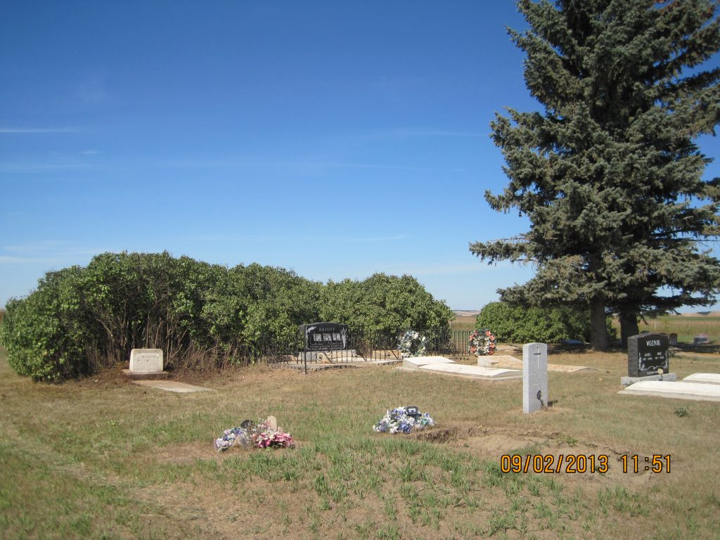
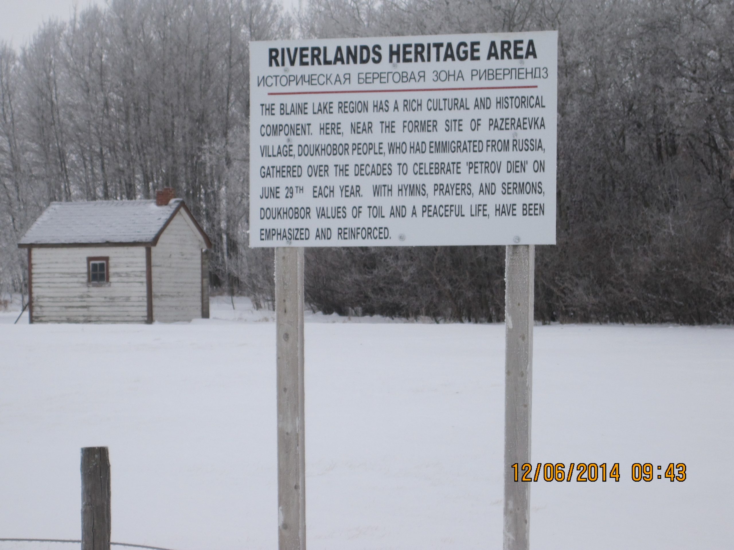
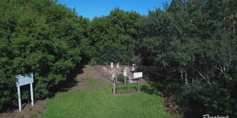
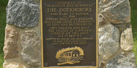
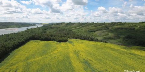
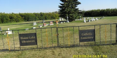
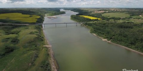
Perched on the high bank southwest of the Petrofka Bridge, this cemetery is one of the oldest in the region. Established in 1899 at the very beginning of the Doukhobor migration, it serves as the final resting place for the founders of the Petrofka Village.
The cemetery is easily identifiable by the tall, mature pine trees standing at its center. According to the local history book Bridging the Years, planting evergreens was a deliberate practice to ensure the cemetery remained visible across the parkland in all weather conditions. Although the village itself disbanded in 1929, the cemetery remains an active and sacred space for the community today.
The site contains approximately 100 graves. As noted in the Saskatchewan Genealogical Society cemetery records, many of the earliest burials are unmarked, representing the pioneers who did not survive the initial hardships of settlement. The well-maintained grounds continue to honor the first generation of settlers who cleared this land.
The cemetery’s location offers a commanding view of the river valley. As documented by historian Jonathan J. Kalmakoff, this site serves as a permanent memorial to the Doukhobor pioneers, overlooking the very banks where they built their first shelters in 1899. It stands as a quiet, reflective conclusion to the Riverlands Heritage Tour.
