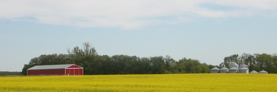
Site #04: The Agricultural Zone
As you travel east of Blaine Lake toward Marcelin and Leask, the landscape reveals the primary engine of the Riverlands’ economy: its soil. This region is a transition zone where the open prairie meets the aspen parkland, creating a unique agricultural environment that has supported generations of diverse farming practices.
The “Black Gold” of the Riverlands
The productivity of this area is due to its Chernozemic soil—a term derived from the Russian words for “black earth.” As described in the University of Saskatchewan’s Saskatchewan Soil Survey (Report No. 12), these deep, organic-rich soils were formed over thousands of years by the decomposition of tallgrass prairie and aspen parkland vegetation. The presence of this “black gold” was the primary draw for the Doukhobor and European settlers at the turn of the century, as it offered some of the highest fertility rates in Western Canada, particularly for cereal crops.
From Mixed Farming to Specialty Crops
In the early 1900s, this area was the heart of “mixed farming.” According to the history book Bridging the Years: Era of Blaine Lake and District 1790-1980, pioneers did not rely on a single crop; they balanced wheat and oats with livestock, legumes, and oilseeds to ensure survival against the unpredictable prairie climate. This diversity acted as a natural insurance policy. Over the decades, as machinery replaced horsepower, the region transitioned toward the vast fields of canola and durum wheat seen today, though the varied “sandy loam” patches still allow for a wide range of specialty crops that are less common in the flatter, heavier clay regions to the south.
A Glacial Legacy
The rolling topography and varied soil types—ranging from heavy black soil to lighter sandy loams—are the result of the last glacial retreat. The Saskatchewan Geological Society records indicate that as the glaciers melted roughly 10,000 years ago, they left behind “glacial till” and outwash deposits that formed the undulating hills and sloughs of the Blaine Lake area. This geography forced settlers to adapt their field patterns to the land’s natural contours, leading to the picturesque, non-linear farmscapes that define the Riverlands today.